Tony Knowles Coastal Trail 2026: Anchorage’s Best Urban Waterfront Path
The Tony Knowles Coastal Trail is eleven miles of paved path running from downtown Anchorage to Kincaid Park along the edge of Cook Inlet — making it one of the few urban trails in North America where you can spot moose, watch for beluga whales, and see a 20,310-foot peak from the same stretch of pavement. The trail is used year-round by walkers, cyclists, joggers, and inline skaters, and its combination of accessibility and scenery makes it the most-used recreational corridor in the city. Here’s what to know for a visit in 2026.
The Route: Downtown to Kincaid Park
The trail begins near the William A. Egan Civic and Convention Center at 5th Avenue and L Street in downtown Anchorage, runs south and west along the bluff edge above the inlet, and ends at the entrance to Kincaid Park on the city’s southwest side. The surface is asphalt throughout, well-maintained, and suitable for road bikes, hybrid bikes, and standard jogging shoes. Elevation change is minimal — the trail follows the coastline contour without significant climbing except for a short rise near the Ship Creek floodplain.
The trail divides loosely into thirds by use: the downtown section from Westchester Lagoon to Earthquake Park sees the heaviest foot traffic and works best for short out-and-backs from the city center; the middle section from Earthquake Park to Point Woronzof gives the longest unobstructed Cook Inlet views and the best beluga watch spots; and the Kincaid section from Point Woronzof to the park entrance carries more cyclists, connects to Kincaid’s 40-mile off-road trail network, and sees fewer pedestrians overall.
Beluga Viewing and Wildlife
The Earthquake Park area, roughly 3.5 miles from the downtown trailhead, is the primary beluga whale viewing point along the trail. Beluga pods move through upper Cook Inlet in summer following salmon runs, and the inlet flats visible from the bluff at Earthquake Park sit directly in their feeding corridor. Sightings happen most reliably in July and August during high tide cycles when the belugas push closer to shore. Our whale watching in Anchorage guide covers tide timing, best viewing windows, and what to look for when scanning the water from Turnagain Arm pullouts to the south.
Moose are a near-daily presence on the trail, particularly in the wooded sections south of Westchester Lagoon and near the Kincaid perimeter. They browse willow and alder at the trail edge and are generally unbothered by foot traffic at a respectful distance. Never approach moose — they’re large, unpredictable, and faster than they look. Bald eagles are common above the inlet, and shorebirds concentrate on the mudflats at low tide throughout the migration windows in May and September.
Cycling the Trail
The Coastal Trail is Anchorage’s most popular cycling route. An eleven-mile one-way ride from downtown to Kincaid takes roughly 45–60 minutes at a comfortable pace. Many cyclists ride to Kincaid, continue on Kincaid’s gravel trails, and return via the same route for a 25–30 mile day. The trail is two-way and shared with pedestrians throughout, so speed and passing awareness matter — slower walkers keep right, faster cyclists pass on the left, and bell use is standard courtesy in busy sections.
Bike rentals are available near the city center. Downtown Bicycle Rental provides cruisers, hybrids, and children’s bikes within walking distance of the downtown trailhead, with single-day and multi-day rates. They also supply trail maps and can advise on current conditions, closures, and Kincaid trail options at the far end.
Access Points and Parking
| Access Point | Mile Marker | Facilities | Parking |
|---|---|---|---|
| 5th Ave / L St (downtown) | 0 | Restrooms nearby, restaurants adjacent | Street or garage |
| Westchester Lagoon | 1.5 | Portable restrooms (seasonal), lagoon access | Free lot off W 15th Ave |
| Earthquake Park | 3.5 | Interpretive signage, benches, open lawn | Free lot off Northern Lights Blvd |
| Point Woronzof | 7 | Picnic area, open inlet views | Free lot, limited spaces |
| Kincaid Park entrance | 11 | Restrooms, trail maps, summer chalet | Large free lot off Raspberry Rd |
Westchester Lagoon is the most common starting point for non-downtown visitors — parking is free, the lagoon hosts ducks and other waterfowl for a short detour, and it puts you 1.5 miles into the trail without downtown pedestrian congestion. The Alaska Public Lands Information Center downtown carries current trail status maps and seasonal closure notices, worth a stop if you’re planning a long ride or visiting outside peak summer.
Denali Views and Scenic Highlights
On clear days — roughly 30–40% of summer days — Denali is visible from the Cook Inlet-facing sections of the trail between Earthquake Park and Point Woronzof. The view is a long-distance silhouette rather than the close profile visible from Talkeetna or the Parks Highway corridor, but from a trail this accessible to a major city, a 20,310-foot peak appearing on the northwest horizon is remarkable. Our scenic viewpoints in Anchorage guide covers where to get the best open-sky views from the trail and around the city, including the bluff overlooks above the inlet that require less than a full eleven-mile commitment to reach.
Winter Use
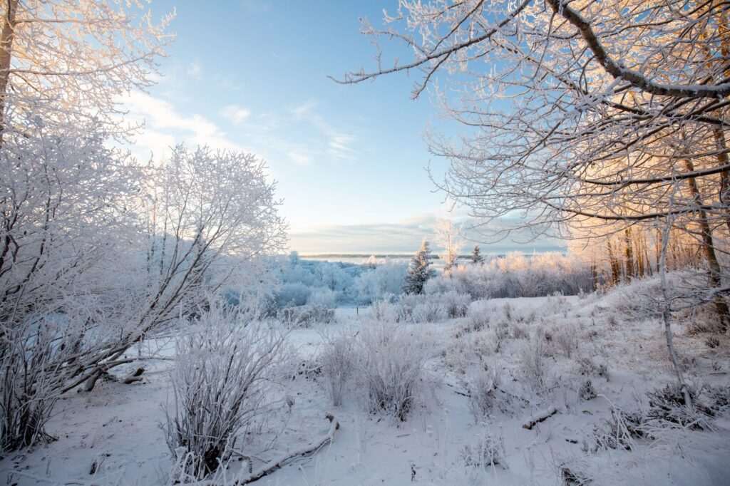
The Coastal Trail stays open and actively used through winter. The Municipality of Anchorage grooms the trail surface for fat biking and cross-country skiing in most winters, and packed snow conditions from December through February make it one of the best winter recreation corridors in the city. Icy sections develop most often on the Point Woronzof and Kincaid segments after freeze-thaw cycles; microspikes are useful from late October through April. Our Anchorage in winter guide covers layering strategy, trail conditions by month, and other winter recreation options that pair naturally with a Coastal Trail visit. Powder Hound Ski & Bike Shop in Midtown carries fat bike rentals and microspike traction devices for winter trail use.
Kincaid Park Connection
Kincaid Park at the trail’s southern end is a 1,517-acre forested park with more than 40 miles of maintained trails — the largest undeveloped greenbelt in Anchorage. In summer the park’s trails are open to mountain biking, trail running, and hiking; in winter they host the Anchorage cross-country ski trail network, including the West Anchorage course used for national-level ski racing. The park’s far south section overlooks Turnagain Arm and the Kenai Peninsula across the water. Far North Bicentennial Park on the east side of the city offers a comparable trail network for those who prefer the Chugach foothills side of the trail system.
Planning Your Visit
- Best months: June through August for maximum daylight and reliable pavement conditions. September brings fewer crowds and exceptional fall color on the wooded sections near Kincaid.
- Time estimate: The full 11-mile walk one-way takes 3.5–4 hours at a comfortable pace. A full round-trip on foot is a full day. Most walkers do 3–5 miles from one access point and return.
- Direction: North to south (downtown toward Kincaid) puts the wind at your back on most summer afternoons when the inlet breeze picks up.
- Wildlife encounters: If a moose is blocking the trail, wait it out or find a wide detour. Never startle or crowd them.
- Tide awareness for belugas: High tide windows shift daily — check tide charts before planning a beluga watch stop at Earthquake Park.
Photo by Angelica Reyn on Pexels.

No comments yet.