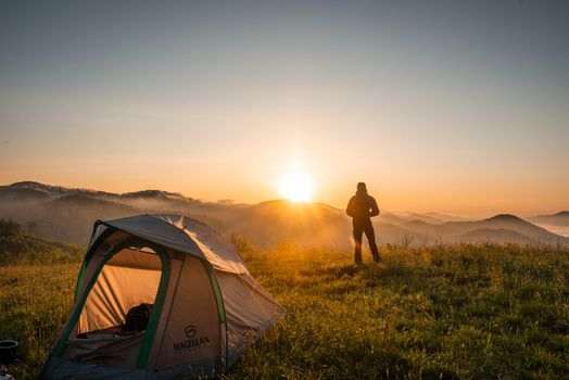
Anchorage Hiking Guide 2026: Best Trails for Every Level
Anchorage sits directly against the Chugach Mountains — the trailhead parking at Glen Alps is 20 minutes from downtown, and from there the trails fan out across one of the largest urban wilderness parks in the world. Chugach State Park covers nearly 500,000 acres immediately behind the city, and the municipal trail system fills in the gaps closer to the urban edge. Here’s a practical breakdown of the best Anchorage hiking options by difficulty in 2026, with terrain, logistics, and what to expect on each.
Beginner Trails
Tony Knowles Coastal Trail
Eleven miles of paved path running from downtown to Kincaid Park along Cook Inlet — not wilderness hiking, but an excellent introduction to Anchorage’s outdoor character. The trail is flat, fully paved, and accessible to all fitness levels. Wildlife (moose, bald eagles, beluga whales from the Earthquake Park section) makes it more interesting than a standard urban path. Most walkers do 3–5 miles out-and-back from any of five access points with free parking. Full details in our dedicated trail guide.
South Fork Eagle River Nature Center
The Albert Loop Trail at the Eagle River Nature Center is an easy 3-mile loop through spruce and birch forest along the South Fork of Eagle River, roughly 12 miles from downtown Anchorage. The trail crosses footbridges over the river, passes beaver ponds, and offers views toward the Chugach peaks without technical terrain. Moose and black bears are regularly seen in this corridor. The nature center has restrooms, interpretive exhibits, and a small staff on summer weekends. Parking: $5 day-use fee at the nature center lot.
Flattop Mountain (Lower Section)
Flattop Mountain’s summit is intermediate-level, but the lower bowl trail from Glen Alps to the sub-summit plateau is a solid beginner option — 1.5 miles round trip with modest elevation gain and wide views of the city and inlet opening up quickly. Families with children age 6 and up handle this section comfortably. For the full summit route and detailed logistics, our Flattop Mountain hiking guide covers the upper scramble terrain and seasonal conditions.
Intermediate Trails
Powerline Pass
The Powerline Pass trail runs 11 miles one-way from the Glen Alps trailhead along the South Fork of Campbell Creek to the Indian Valley trailhead on Turnagain Arm — a long valley walk with consistent mountain views and no technical terrain. Most hikers do the first 4–6 miles as an out-and-back from Glen Alps, reaching the broad open valley floor where the trail crosses tundra and passes waterfalls before climbing toward the pass. Mountain bikes are permitted on the Powerline corridor, making it one of the few legal off-road bike routes in Chugach State Park accessible from the main trailhead. Elevation gain: approximately 1,400 feet to the pass. Round-trip to pass: 22 miles — overnight or shuttle recommended for through-hikers.
Flattop Mountain Summit
Flattop is the most-climbed peak in Alaska, which understates rather than overstates how good the experience is. The 3.4-mile round trip from Glen Alps gains 1,350 feet to the summit at 3,510 feet — a straightforward trail that turns into a rocky scramble on the final 400 feet to the summit plateau. No technical gear required in summer, but the scramble section involves hand-over-foot moves on loose rock that surprises first-timers. The 360-degree summit view includes Denali on clear days, Cook Inlet, the Kenai Peninsula, and the full Anchorage bowl. See our dedicated guide for the complete logistics.
Williwaw Lakes Loop
The Williwaw Lakes Loop from the upper Glen Alps trailhead covers 7.8 miles and passes six alpine lakes in a glacially-carved cirque basin above the Campbell Creek drainage. Trail conditions are good through mid-October; earlier in summer, snow patches may persist above 3,000 feet. The trail involves stream crossings that can be wet in high-melt periods (June–July). An outstanding intermediate day hike with consistent alpine scenery and relatively low foot traffic compared to Flattop.
Advanced Trails
Crow Pass Trail
Crow Pass is the most frequently recommended advanced day hike in the Anchorage area — a 12.5-mile point-to-point from Girdwood (Crow Creek Road trailhead) to the Eagle River Nature Center. The trail climbs through the Chugach to a 3,400-foot pass, crosses Raven Glacier, descends a dramatic valley, and fords the Eagle River (a genuine ford requiring trekking poles and caution, not a bridge crossing). The ford depth varies significantly with snowmelt — July crossings after heavy melt years can be thigh-deep. Shuttle logistics between Girdwood and Eagle River require a two-car setup or coordination. Total elevation gain: approximately 2,200 feet. This is a full 8–10 hour day for most parties.
Peak Scrambles from Flattop Ridge
The ridge extending north from Flattop connects to Ptarmigan Peak and the Rabbit Lake basin — experienced scramblers with route-finding ability can extend a Flattop summit into a multi-peak day. No technical gear required in dry summer conditions, but exposure and loose rock increase significantly beyond Flattop’s summit. The Rabbit Lake trail from the upper Glen Alps lot is also a straightforward approach for experienced hikers wanting a quieter alpine lake objective without the Flattop crowds.
Access: Glen Alps and the Chugach Trailheads
Most Chugach State Park trails access from two main trailheads off Upper Huffman Road and Hillside Drive on Anchorage’s south side. Glen Alps (main lot) and the upper Glen Alps lot serve Flattop, Powerline Pass, Williwaw Lakes, and the Rabbit Lake basin. The Prospect Heights trailhead off O’Malley Road gives access to Wolverine Peak and the Gasline Trail. All Chugach State Park trailheads charge a $5 parking fee (exact change or credit card). Downtown hotel visitors need a car — no trailhead is within walking distance of the city center.
Far North Bicentennial Park on the east side of the city offers a trail network connecting to the Chugach foothills — good for mountain biking and trail running closer to the Muldoon and Tudor Road corridors without paying the Chugach State Park fee.
Seasonal Conditions and Gear
| Month | Conditions | Notes |
|---|---|---|
| May | Snow above 2,000 ft; muddy lower trails | Microspikes useful; waterproof boots recommended |
| June | Snow receding; stream levels high from melt | Crow Pass ford can be challenging; all other trails open |
| July–August | Peak summer; all trails fully open | Mosquitoes heavy in lower valley sections through mid-July |
| September | Excellent — less crowded, fall color, dry trails | Early snow possible above 4,000 ft from mid-September |
| October | Snow at elevation; lower trails good through month | Waterproof layers and traction devices needed |
Bear spray is standard equipment for all Chugach State Park trails — both black and brown bears are present throughout the park. Carry it accessible and know how to use it before you need it. Powder Hound Ski & Bike Shop in Midtown stocks bear spray, trekking poles, and waterproof layers for visitors who need to gear up before heading out.
The Alaska Public Lands Information Center on 4th Avenue has current trail conditions, Chugach State Park maps, and staff who can advise on route selection for any difficulty level. For hikers planning overnight trips in the Chugach backcountry, our camping near Anchorage guide covers Eagle River campground and dispersed camping options within the park system.

No comments yet.