Powerline Pass Trail Anchorage 2026 — Easy Alpine Walk from Glen Alps
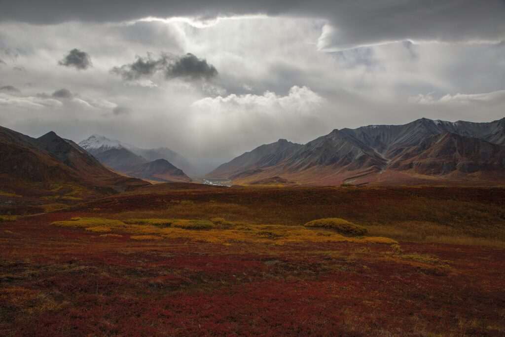
Powerline Pass Trail is Anchorage’s most accessible alpine walk — a wide, open route that follows an old utility corridor from the Glen Alps trailhead into the high country of Chugach State Park. The trail is 11 miles round trip to the pass with about 2,000 feet of elevation gain, but it earns its reputation not just from that distance — it earns it from the landscape you walk through. Within a mile of the trailhead the terrain opens completely: a broad valley, tundra rolling away on both sides, mountains closing in ahead. It’s one of the most dramatic transitions in Anchorage hiking, and it happens fast.
The Trail Character
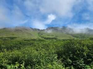
Powerline Pass follows the route of a historical powerline easement through the lower portion of the valley, which is why the trail is wide, clearly defined, and free of the dense vegetation that crowds some Chugach trails. The trade-off is exposure — the open valley offers no shade and catches whatever wind is moving through the mountains — but it’s also what gives the trail its panoramic quality from early on. You’re not hiking through a tunnel of spruce toward a distant viewpoint. The viewpoint is the trail.
The grade is gentle in the lower valley and steepens through the upper section as the valley narrows toward the pass. Most of the 2,000 feet of gain comes in the final miles. The trail surface is variable — packed dirt and gravel through the lower tundra section, rocky and loose near the pass — but no technical scrambling is required at any point. It is an honest, straightforward alpine walk.
The View from Powerline Pass
The pass sits at approximately 3,550 feet and rewards the climb with 360 degrees of mountains. Looking east, the Chugach peaks recede into the backcountry — the same range that forms Anchorage’s backdrop, but you’re inside it now. Looking west, on a clear day you can see the city spread across the coastal plain, Cook Inlet beyond it, and occasionally Denali rising on the horizon 130 miles away. The near view is rock and tundra. The far view is the full width of southcentral Alaska.
Near Point is a popular detour from the lower trail for those wanting additional elevation. Rabbit Lake trail branches south through the valley toward a remote alpine lake.
Wildlife
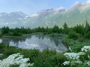
Dall sheep are the wildlife signature of Powerline Pass. The white sheep are visible on the rocky upper slopes throughout the hiking season, and the open terrain means sightings are common — not the distant speck-on-a-ridge experience of many Alaska peaks, but close enough to resolve through binoculars into distinct animals. Ptarmigan move through the tundra in small flocks, often heard before they’re seen. Marmots are abundant and vocal in the rocky sections of the upper valley; golden eagles ride thermals above the ridgelines through summer. In the lower sections near the trailhead, moose use the willows and shrub vegetation year-round. Carry bear spray — the valley is active bear habitat in late summer when berries ripen on the tundra slopes.
Trip Planning: Short vs. Full Day
The full 11-mile round trip to Powerline Pass and back takes 5 to 7 hours and is the objective most hikers are working toward. But Powerline Pass Trail is unusually rewarding at shorter distances. At 3 miles round trip, you’re already in open alpine tundra with mountain views on all sides. At 4 to 5 miles, you’re deep in the valley with the pass visible ahead. Many Anchorage residents walk the lower section on weekday evenings without any ambition of reaching the pass — the trail delivers scenery proportionally, not all at once at the top.
The trail connects at the far end to the broader Chugach State Park trail network. Parties planning long point-to-point routes can descend into other drainages — the Far North Bicentennial Park area and the Eagle River Nature Center corridor represent entirely different terrain and character, accessible from the same backcountry trail system.
Season and Conditions
Peak season runs from late June through September. Snow lingers on the upper valley and around the pass into June in most years — microspikes help in early season. By July the trail is fully clear and the tundra is at its greenest. September brings fall color to the low vegetation: the tundra turns gold and rust, the birch patches below glow yellow, and the crowds thin. Winter use is common on the lower trail section, which is a popular snowshoe and ski touring route when snow conditions allow.
For trail comparison, Bird Ridge Trail on the Seward Highway offers a contrasting experience — a steep front-range climb with strong Turnagain Arm views — while Powerline Pass Trail emphasizes the valley and the pass rather than the ridge. The two represent distinct characters of Chugach hiking.
Getting There
The Glen Alps trailhead is in the Hillside area of east Anchorage, about 20 to 25 minutes from downtown. Follow O’Malley Road east to Hillside Drive, then continue south and east to the upper Glen Alps parking area. The lot is paved and well-signed; GPS navigates reliably to the trailhead. A state park day-use fee applies — cash or a valid Alaska State Parks annual pass. The parking area has restrooms and a trail information kiosk. The lot serves multiple popular trails and fills early on clear summer weekends; arrive before 9 a.m. to guarantee a spot.
How long is Powerline Pass Trail?
The full trail to Powerline Pass and back is approximately 11 miles round trip with about 2,000 feet of elevation gain. Most hikers complete the round trip in 5 to 7 hours. Shorter out-and-back trips are rewarding at 3 to 5 miles — the open alpine terrain begins well before the pass.
Is Powerline Pass Trail difficult?
Moderate. The distance and elevation gain make it a genuine half-day or full-day effort, but there is no technical scrambling. The trail is wide and clearly defined. Main challenges are the sustained climb in the upper valley and open exposure to wind and weather.
When is the best time to hike Powerline Pass Trail?
Late June through September. Snow can linger in the upper valley into June; microspikes help early in the season. July and August are peak months. September brings fall color to the tundra and fewer crowds.
Is there parking at Glen Alps trailhead?
Yes — a paved lot with restrooms. A state park day-use fee applies. The lot fills early on sunny summer weekends; arriving before 9 a.m. is the reliable strategy.
Featured photo by Mike Knibbs on Pexels.

No comments yet.