Gold Mint Trail Hatcher Pass: Alpine Valley Hike 2026
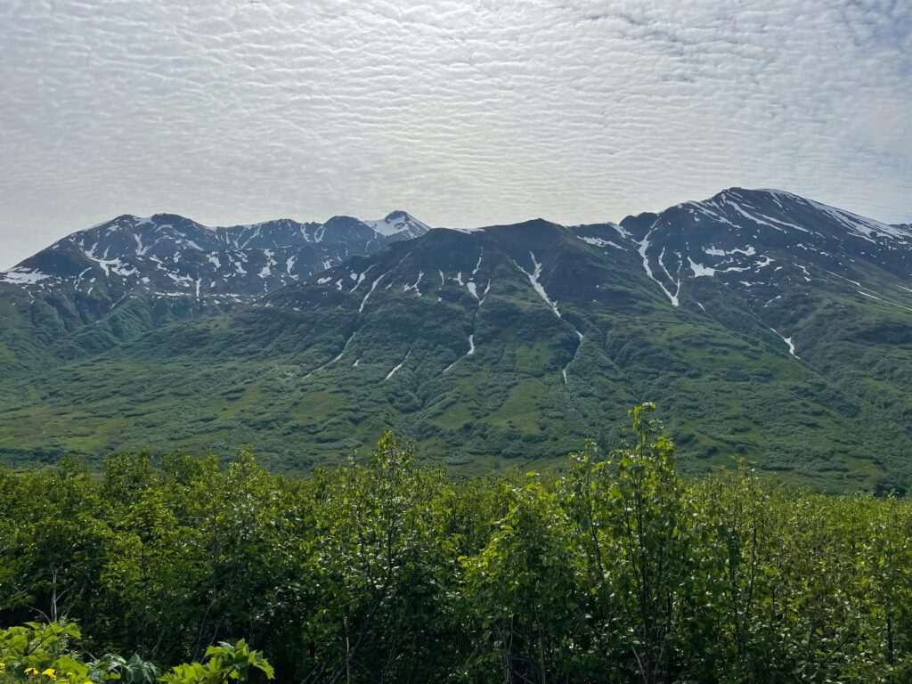
The Archangel Valley in Hatcher Pass holds two of the best hikes in Southcentral Alaska, and the Gold Mint Trail is the one that rewards hikers who like their scenery in motion: cascading creeks, waterfalls spilling off granite faces, July wildflower meadows stretching up both sides of the valley, and the Mint Glacier waiting at the end. Eight miles round trip with 1,500 feet of elevation gain, Gold Mint follows Mint Creek from the trailhead through one of the most visually dramatic valleys in the region to a glacier you can walk directly to. It’s 75 miles from Anchorage and earns every mile of the drive.
The Trail
The Gold Mint Trail begins at the same Archangel Valley Road trailhead as the Reed Lakes Trail, but takes its own branch up the valley. The first few miles move through willow and alder thickets alongside Mint Creek, which runs fast and clear with snowmelt through June and early July. The trail gains elevation gradually at first, the creek audible throughout and the valley walls rising on both sides into granite ridgelines. Waterfalls drop off the upper cliffs in early summer — most visible before mid-July when snowmelt from the upper slopes is still running full.
The valley opens significantly above mile 3, the vegetation giving way to alpine meadow and the views extending back down the valley toward the Archangel Road below. Wildflowers peak here in mid-July: monkshood, fireweed, mountain aven, and scattered patches of arctic paintbrush across the meadow floor. The Mint Glacier becomes visible ahead as the trail rises into the upper valley, its tongue extending down from the cirque that feeds it. The final approach to the glacier toe crosses talus and moraine — straightforward but requiring attention to footing. You can walk to within a short distance of the ice.
Difficulty
Gold Mint is a moderately strenuous hike. The 8-mile round trip involves 1,500 feet of elevation gain spread across the full length of the trail, making the climb sustained rather than steep. Plan 5 to 7 hours for the round trip with time at the glacier. There’s no technical climbing or serious scrambling — the trail is clear to the glacier toe — but the sustained length and exposed upper section make it a meaningful day. Trekking poles are useful on the return descent from the upper valley.
Creek crossings on the lower trail can run high after rain or during peak snowmelt in June — waterproof boots are worth carrying regardless of the season forecast. The upper valley channels wind from the glacier even on warm days; a light windproof layer belongs in your pack year-round on this trail.
Wildlife
Dall sheep are common on the ridgelines flanking the upper valley — the rocky terrain above the glacier approach is prime habitat, and clear days usually produce sightings visible with binoculars. Marmots are abundant through the upper meadows, and ptarmigan are present in the talus fields above treeline. The lower valley near the creek draws moose, particularly in the alder and willow thickets in the first mile. Bear spray is standard equipment here; both black and brown bears use the Archangel Valley corridor.
Getting There
The Archangel Valley trailhead is approximately 75 miles from downtown Anchorage via the Hatcher Pass Road corridor. From Anchorage, drive the Glenn Highway northeast to Palmer, then follow Fishhook Road northwest into the mountains. Hatcher Pass Road climbs into the Talkeetna Mountains; stay on it past the Independence Mine area and turn onto Archangel Valley Road, a gravel spur leading to the trailhead. Standard passenger vehicles handle the road fine at moderate speeds.
Cell service is unreliable in the valley — download offline maps before leaving. Parking is free but the lot fills quickly on summer weekends; arriving by 8 AM is recommended.
Combining with a Full Hatcher Pass Day
The Independence Mine State Historical Park is a natural add-on — the preserved gold mine complex from the 1930s and 1940s is a few miles back down Hatcher Pass Road from the Archangel turnoff, with self-guided tours through well-maintained historic buildings. It pairs particularly well with Gold Mint Trail since the mining history of the area is visible right in the valley you just hiked through.
For the drive back toward Anchorage, the Musk Ox Farm in Palmer is a worthwhile stop — the only farm dedicated to domesticating musk oxen, with close-up animal viewing and exhibits on qiviut fiber. If you want to extend the day further, Matanuska Glacier is accessible from the Glenn Highway on the return route, about an hour east of Palmer.
How long is Gold Mint Trail?
Gold Mint Trail is approximately 8 miles round trip from the Archangel Valley trailhead to the toe of the Mint Glacier. Elevation gain is about 1,500 feet. Most hikers complete the round trip in 5 to 7 hours, including time at the glacier.
Is Gold Mint Trail difficult?
It’s moderately strenuous. The elevation gain is spread over the full length of the trail, making the climb sustained rather than technical. There’s no scrambling required to reach the glacier toe. Fit hikers with basic trail experience will find it challenging but very accessible. Waterproof boots and trekking poles are recommended.
When is the best time to hike Gold Mint Trail?
Mid-July through September. The trail is typically snow-free by late June, but the wildflower peak in the upper meadows hits mid-July and the creek crossings are calmer by then. September brings cooler temperatures and less crowding. Avoid early June — creek crossings run high from snowmelt and the upper trail may still have snow.
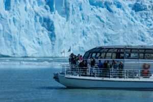
Can you get close to the Mint Glacier?
Yes — the trail leads directly to the glacier toe without requiring technical equipment. You can approach the edge of the ice on foot. Standard precautions apply: stay back from unstable ice margins and avoid walking beneath seracs or heavily fractured areas at the glacier edge.
Gold Mint Trail delivers a complete Alaska hiking experience in 8 miles: the creek, the wildflowers, the granite walls, and a glacier at the end you can walk right up to. Start early from Anchorage, leave time for Independence Mine on the drive out, and add the Musk Ox Farm in Palmer on the way home. It’s one of the best full days accessible from the city.
Featured photo by Emma Buchman on Pexels.
No comments yet.