Gates of the Arctic National Park 2026: Alaska’s Most Remote Wilderness
There are national parks, and then there is Gates of the Arctic. The northernmost park in the United States — 8.4 million acres positioned entirely above the Arctic Circle, straddling the Brooks Range across six of Alaska’s wildest river drainages — has no roads inside its boundaries, no maintained trails, no visitor centers within the park, no rangers in the backcountry, and no rescue infrastructure. What it has is wilderness in its most complete and demanding form: mountains that have never been bisected by a highway, rivers that have never been dammed, caribou herds that migrate without encountering fences, and silence of a quality that is simply unavailable anywhere else in the country. For experienced wilderness travelers who are genuinely prepared for what they’re asking of themselves, Gates of the Arctic delivers an experience that has no equivalent.
The Scale of the Place
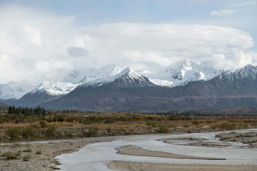
Gates of the Arctic is the second-largest national park in the United States — larger than Maryland — stretching from the Noatak watershed in the west toward the Yukon Territory in the east. The park encompasses the central and western Brooks Range, ancient mountains rising past 8,000 feet before dropping into broad river valleys. This is not the tourist-facing version of Alaska wilderness: it is a landscape where weather changes in hours, creek crossings become dangerous with a day of rain upstream, and the nearest help is a satellite phone call and a bush plane flight away.
The name comes from Robert Marshall, who explored the Brooks Range in the 1930s and named two peaks flanking the North Fork of the Koyukuk River — Frigid Crags and Boreal Mountain — the “Gates of the Arctic.” Congress designated the park in 1980 under the Alaska National Interest Lands Conservation Act. Today it receives fewer than 10,000 visitors per year, among the fewest of any park in the system.
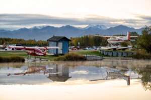
Getting There: The Fundamental Challenge
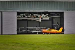
There is no road into Gates of the Arctic. Access requires either a bush plane or a long backcountry approach on foot from the Dalton Highway, which runs along the park’s eastern boundary. Most visitors fly in.
The primary staging points are Fairbanks and Coldfoot — both connected to the park by bush plane or floatplane. From Fairbanks, charter flights reach village airstrips at Bettles, Anaktuvuk Pass, and other communities on or near the park boundary, typically in 90 minutes to two hours. From Coldfoot (at mile 175 of the Dalton Highway), flights are shorter — under an hour to most northern entry points. Aircraft typically include de Havilland Beavers and Cessna 206s, the workhorses of Alaska backcountry aviation. Floatplanes land directly on lakes throughout the park’s interior, allowing parties to be dropped at expedition start points with no airstrip required.
For those approaching overland, the Dalton Highway provides access corridors where experienced hikers can enter the park on foot — most commonly from Coldfoot toward the Koyukuk drainage, involving 10 to 20 miles of off-trail tundra travel. This is an expedition approach requiring prior Alaska backcountry experience, not a day hike.
For Anchorage-based visitors, bush aviation services including Rust’s Flying Service can arrange or coordinate charter connections to the Brooks Range; the logistics typically involve commercial flight to Fairbanks followed by charter from there. Guided wilderness experiences with operators like Adventures by True North can also structure full logistics for parties who want expert-guided access without arranging each component independently.
The Landscape: Brooks Range Wilderness
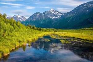
The Brooks Range is not like any other mountain environment in the United States. These are not the dramatic glacially carved peaks of the Alaska Range to the south, nor the forested ranges of the Pacific Coast. The Brooks Range is austere — exposed limestone and schist ridgelines above the treeline, broad open valleys threaded by braided rivers, tundra slopes covered in dwarf birch, sedge, and cottongrass that turns gold and crimson in late August. The landscape is horizontal as much as it is vertical: the eye ranges across open terrain for miles in every direction, with weather systems visible long before they arrive.
The rivers are the park’s highways. The North Fork of the Koyukuk, the Alatna, the John, the Tinayguk, the Noatak — these drainages define the geography and provide the routes through terrain that would otherwise require scrambling over ridgeline after ridgeline. The rivers run clear over gravel bars in summer, clouded with glacial flour in early season. Their banks carry the only vegetation approaching tree height: alder and willow thickets that conceal animals at close range.
Wildlife
Gates of the Arctic sits within some of the most productive wildlife terrain in North America. The Western Arctic Caribou Herd — one of the largest caribou herds on earth, numbering approximately 200,000 animals — migrates through the park in both spring and fall. Seeing this migration is one of the transformative wildlife experiences available anywhere in the world: a river of animals moving across tundra that has no roads, no fences, no human structure to interrupt their passage. The timing of migration is variable and weather-dependent; late July through September is the window when animals are most likely to be passing through the central Brooks Range.
Grizzly bears are present throughout the park at high density — the Brooks Range supports one of the healthiest grizzly bear populations in Alaska, and encounters are likely on any extended visit. These are interior grizzlies, leaner than their coastal counterparts, highly adapted to the boom-and-bust caloric cycle of the Arctic. Wolves and wolverines range widely through the drainages. Dall sheep hold the high ridgelines, and musk oxen — reintroduced after being hunted to extirpation — appear on the North Slope tundra near the park’s northern margins.
River Float Trips: The Primary Way to Travel Inside
For most visitors, a river float is how the park interior is experienced. The classic routes are the North Fork of the Koyukuk (accessed from Bettles, flowing south through the heart of the Brooks Range named by Robert Marshall), the Alatna River (a remote and uncommonly beautiful route through the western park), and the Noatak River (a multi-week expedition route descending from the Brooks Range headwaters all the way to Kotzebue on the coast). These are wilderness float trips requiring packrafts or folding canoes that can be flown into a lake or airstrip start point, not commercial-grade inflatable rafts launched from a put-in with a road.
The Noatak is the longest of these routes — a complete descent runs approximately 350 miles and takes 3 to 4 weeks, though shorter sections are accessible by flying into mid-river points. All routes require packraft or folding canoe capable of Class I–III whitewater, navigation without marked channels, and complete self-support for the duration.
Planning, Preparation, and What the Park Requires of You
Gates of the Arctic is the most demanding national park in the United States for a simple reason: there is nothing to catch you if something goes wrong. No trail system means navigation is entirely on the visitor. No rangers in the backcountry means no one is checking on you. No communications infrastructure means cell phones are inoperable throughout the park. A satellite communicator — Garmin InReach or equivalent — is not optional; it is the difference between a manageable emergency and a fatal one.
The NPS Fairbanks office provides essential pre-trip consultation on current conditions, river levels, and bear activity. No backcountry permits are required, but registering with the NPS before entering is standard practice — rangers need to know someone is out there.
Preparation for a Gates of the Arctic trip involves not just gear but documented experience. Visitors should have prior Alaska backcountry travel experience, river crossing competency, bear encounter protocols down cold, and the physical conditioning for days of off-trail tundra travel carrying a full expedition pack. Gear requirements include the full Alaska backcountry suite: waterproof everything, bear canister, extensive first aid capability, emergency shelter, and a float plan left with a responsible contact outside the park. Big Ray’s Outdoor Gear in Anchorage carries the Alaska-specific gear — packraft accessories, cold-weather insulation layers, bear protection, and communication devices — that this kind of trip demands.
Why Gates of the Arctic
The honest answer is that there is no substitute for what Gates of the Arctic offers. Most Alaska visitors experience the state through car windows, from tour boats, from the seat of a charter aircraft. Gates of the Arctic requires you to be in it — on foot, in a packraft, in the weather, moving through terrain that has not been smoothed or signed or made approachable. The caribou crossing the tundra in front of you have no idea what a tourist is. The river you’re floating has never been dammed. The mountains named by Robert Marshall in the 1930s look exactly as he described them. In a world where wilderness increasingly means a managed approximation of the real thing, Gates of the Arctic remains the real thing.
Photo: John De Leon / Pexels
No comments yet.