Anchorage 1964 Earthquake History — Earthquake Park & the Good Friday Quake 2026
On the evening of March 27, 1964 — Good Friday — the ground beneath Anchorage began to shake. What followed was four and a half minutes of violent, rolling motion that became the most powerful earthquake ever recorded in North American history: a magnitude 9.2 event centered 75 miles east of Anchorage in Prince William Sound. By the time the ground stilled, Anchorage had been fundamentally altered — neighborhoods had dropped a dozen feet, downtown streets had crumbled, and the residential bluffs of Turnagain Heights had collapsed into Cook Inlet. Today, Earthquake Park stands on those same bluffs as a quiet memorial to one of the most significant seismic events in recorded history — and one of Anchorage’s most compelling and undervisited destinations.
What Happened on Good Friday 1964
The 1964 Alaska earthquake struck at 5:36 p.m. local time, as families were returning home from church services. Its epicenter was in Prince William Sound, and its effects were felt from Kodiak Island to Seattle. In Anchorage — the largest city closest to the epicenter — the destruction was extensive. Downtown’s Fourth Avenue dropped several feet along a fault line running through the commercial district. The Turnagain Arms apartment complex fell. Schools, hotels, and homes collapsed across the city. Of the 139 people killed across Alaska, 9 died in Anchorage directly — the rest perished in the tsunamis the earthquake generated along the Kenai Peninsula coast, Kodiak Island, and communities as far south as Crescent City, California.
The shaking lasted four and a half minutes — an eternity in earthquake terms. Survivors described it as rolling, like waves in the ocean, with the ground visibly undulating. Trees swayed and snapped. Chimneys toppled. Power lines fell. But the most dramatic destruction came not from the shaking itself but from what the shaking did to the unstable clay layers beneath Anchorage’s residential neighborhoods.
The Collapse of Turnagain Heights
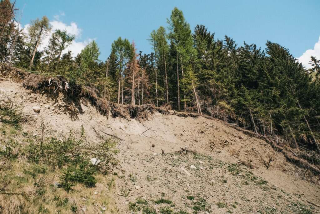
The neighborhood of Turnagain Heights, perched on a bluff above Cook Inlet on Anchorage’s west side, experienced a geologic failure unlike anything seen in modern North American history. The neighborhood sat above layers of Bootlegger Cove Clay — a marine clay deposited after the last ice age that, when subjected to intense shaking, loses its structural integrity through a process called liquefaction. As the earthquake shook, the clay beneath Turnagain Heights turned to liquid, and roughly 130 acres of land slid toward Cook Inlet in a catastrophic bluff failure.
Approximately 75 homes were destroyed in the slide. Residents fled on foot as the ground broke apart beneath them, with house-sized blocks of earth tilting and dropping into the chaos below. Because the earthquake struck on a holiday evening rather than during a school or workday, casualties in the neighborhood were limited — but the destruction was total. The neighborhood was never rebuilt. Instead, it was converted into green space and eventually became the corridor now occupied by the Tony Knowles Coastal Trail and Earthquake Park.
Earthquake Park Today
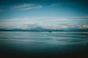
Earthquake Park sits at the western end of Northern Lights Boulevard, overlooking Cook Inlet and the Alaska Range. Entry is free and the park is open year-round. The site is modest but evocative: a bluff-top open area with interpretive signage describing the earthquake’s effects, the geology that made Turnagain Heights so vulnerable, and the long process of recovery. The views from the bluff — across Cook Inlet to the Sleeping Lady (Mount Susitna), with Denali visible on clear days to the northwest — are among the finest in the city.
An earthquake monument at the park marks the significance of the event and serves as a gathering point for visitors. The hummocky, irregular terrain visible on the bluff reflects the surface disruption from the 1964 slide — the ground here was never graded flat, and the uneven landscape is a physical record of what happened that evening. Walking the bluff edge, it’s possible to imagine the scale of what was lost. On clear summer days, beluga whales have been spotted from the bluff as they follow salmon into the inlet’s shallow waters in late summer.
What to See at the Park
First-time visitors often underestimate how much there is to absorb. The main feature is a concrete monument with interpretive panels describing the earthquake’s magnitude, duration, and effects. The panels include before-and-after maps of Turnagain Heights, photographs taken in the days after the quake, and geological diagrams explaining the Bootlegger Cove Clay failure. For visitors with children, the explanation of why the ground moved the way it did is often more memorable than the statistics alone.
The irregular terrain is worth exploring slowly. Unlike a conventional memorial, Earthquake Park does not smooth over what happened — the slope breaks and uneven bluff edge are all artifacts of the 1964 collapse. Allow 30 to 60 minutes to read the interpretive panels thoroughly and walk the bluff. Parking is free and ample directly off Northern Lights Boulevard. Dogs are welcome on leash.
The park connects directly to the Tony Knowles Coastal Trail, Anchorage’s 11-mile paved multi-use path along Cook Inlet. A suggested half-day itinerary: start at Earthquake Park, walk the bluff and read the interpretive panels, then pick up the Coastal Trail southward. The trail passes Westchester Lagoon — an excellent birdwatching spot with nesting waterfowl and frequent moose sightings — before continuing toward Kincaid Park. This combination makes for one of Anchorage’s most distinctive outings: free, outdoor, and deeply connected to the city’s story.
The Aftermath and Anchorage’s Rebuilding
The 1964 earthquake catalyzed enormous changes in how Alaska and the United States approached seismic risk. Anchorage was rebuilt quickly with federal disaster assistance and new building codes incorporating seismic standards. Areas identified as vulnerable to the same clay liquefaction that destroyed Turnagain Heights were rezoned away from dense residential development. The reconstruction of downtown, the rebuilding of the port, and the upgrading of infrastructure laid the groundwork for Anchorage’s growth through the 1970s oil boom. The city visitors see today bears the earthquake’s imprint in ways that are invisible on the surface but deeply legible to anyone who knows the history.
The Anchorage Museum and Earthquake History
For visitors who want to go deeper than the park’s interpretive signage, the Anchorage Museum holds significant collections related to the 1964 earthquake and Alaska’s broader seismic history. Photographs, oral histories, and archival materials document the immediate aftermath, the relief efforts, and the rebuilding years. The museum’s Alaska History Gallery places the earthquake in the context of the broader story of human settlement in earthquake-prone Alaska. For families or visitors with particular interest in the geological or social history of the event, the museum is an essential companion stop.
Alaska’s Ongoing Seismic Activity
Alaska remains one of the most seismically active regions on earth. Small earthquakes are common in the Anchorage area — residents feel them several times per year. The 2018 magnitude 7.1 earthquake centered near Anchorage was a reminder that the forces that produced 1964’s catastrophe remain active. The Alaska Earthquake Center, operated by the University of Alaska Fairbanks, continuously monitors seismic activity across the state and maintains public data on recent events. Its website provides real-time earthquake information for visitors curious about Alaska’s seismic character.
Planning Your Visit
Earthquake Park is located at 4300 W. Northern Lights Boulevard. It is free, open dawn to dusk, and accessible year-round — though the bluff trail can be icy in winter and is best navigated with care. The park is a five-minute drive from downtown Anchorage and sits directly on the route between the city center and the Coastal Trail’s northern access points.
The 1964 earthquake made Anchorage what it is. Visiting Earthquake Park is not just a history lesson — it is a chance to stand on ground that moved, in a city rebuilt from that movement, looking out at the same inlet the 1964 slide pushed toward. No other city in North America offers that experience.
Featured photo by Andreas Schnabl on Pexels.


No comments yet.