Turnagain Arm Scenic Drive: Seward Highway Guide 2026
The Turnagain Arm scenic drive along the Seward Highway from Anchorage is one of the most spectacular road trips in North America — and you don’t need to leave the city for long to do it. Designated an All-American Road, the route hugs the edge of a glacially carved tidal inlet with mountains rising thousands of feet on both sides, Dall sheep visible on the cliffs above, and one of the world’s largest tidal bores rolling in from Cook Inlet. This guide covers every worthwhile stop heading south from Anchorage toward Portage Valley, with timing tips and practical info for a half-day or full-day drive.
The Route at a Glance
The Seward Highway south from Anchorage follows Turnagain Arm for roughly 45 miles before the terrain opens into the broad Portage Valley. Mile markers count down from Anchorage — start at Mile 127 (downtown) and drive south. All the stops below are signed and easy to reach with any rental car. The full drive to Portage Glacier takes about 1.5 hours without stops; plan 4–6 hours to do it properly.
Potter Marsh — Mile 117
The first worthwhile pull-out south of town is Potter Marsh, where a free boardwalk extends over a wetland sanctuary just off the highway. From May through August, the marsh hosts nesting Arctic terns, trumpeter swans, Canada geese, and a rotating cast of shorebirds. Moose wade into the shallows in early morning. It’s a ten-minute detour that regularly surprises people who weren’t expecting wildlife this close to a major city.
Visit the Potter Marsh Bird Sanctuary listing for current conditions and boardwalk access details. Restrooms on-site. Free.
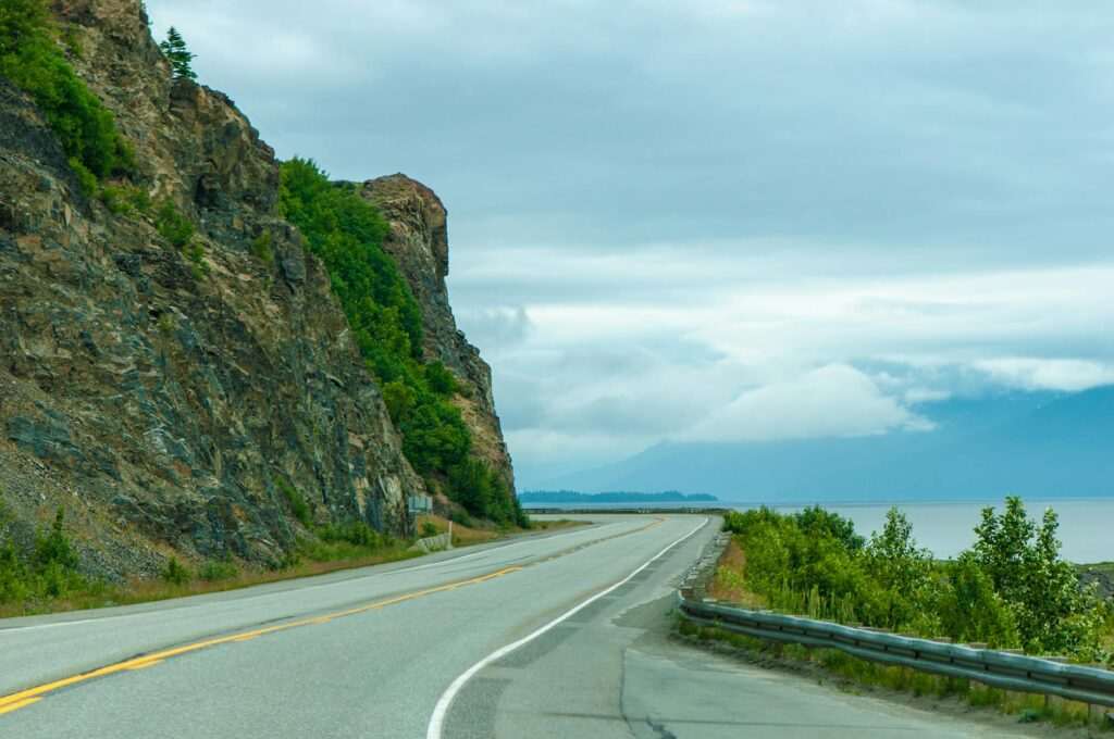
McHugh Creek — Mile 111
McHugh Creek offers a picnic area at the base of dramatic cliffs where Dall sheep — Alaska’s white mountain sheep — are frequently visible through binoculars on the rock faces above. A short trail climbs from the parking area toward the creek; the full McHugh Creek Trail continues to a ridge with inlet views for those who want more elevation. The McHugh Creek Trail is a solid option if you want to stretch your legs mid-drive without committing to a full hike.
Beluga Point — Mile 110
Beluga Point is the designated pull-out for two of Turnagain Arm’s most memorable sights: beluga whales and the bore tide. The point earned its name from the small pod of Cook Inlet beluga whales — a critically endangered population of roughly 300 animals — that regularly feed along this stretch of the arm in summer. Sightings aren’t guaranteed, but they’re common enough that it’s worth bringing binoculars and watching the water for 10–15 minutes. The bore tide (see below) also hits Beluga Point clearly, making this the best single viewpoint on the arm.
The Bore Tide: Timing and What to Expect
Turnagain Arm produces one of the largest tidal bores in the world — a wall of water that surges up the inlet as the tide rushes in, reaching 6 feet in height at peak conditions. The bore forms because the arm’s funnel shape accelerates the incoming tide into a visible wave front that travels the full length of the inlet.
To see it: check the Anchorage tide tables online and add approximately 2 hours to the time of the Anchorage high tide — that’s roughly when the bore passes Beluga Point. The bore is most dramatic during the highest tides (9+ feet). Arrive 15 minutes early and watch from the designated pull-out above the mudflats. Never go onto the mudflats themselves — Turnagain Arm’s glacial silt quicksand is legendary, and several people have died after becoming trapped when the tide returned.
Girdwood Turnoff — Mile 90
The turnoff for Girdwood, about 40 miles south of Anchorage, is worth a detour if you have the time. The village sits in a valley below Alyeska Resort — Alaska’s largest ski resort, which operates a tram to the summit year-round for summer hiking and mountain views. The Alyeska Resort tram runs daily in summer and delivers you to a top-of-the-world viewpoint without breaking a sweat. Winner Creek Trail, accessible from the resort area, leads through old-growth spruce forest to a hand-drawn tram crossing over a canyon — one of the more underrated short hikes in Southcentral Alaska.
Girdwood also has a handful of good restaurants, a coffee shop, and a notably relaxed vibe for a ski town in summer. Budget an extra 1.5–2 hours if you go in.
Portage Valley — Mile 79
The Portage Valley turnoff leads into one of the most photogenic glacial valleys in Alaska, and it’s only 6 miles off the highway. The valley holds three worthwhile stops:
- Begich-Boggs Visitor Center — the Forest Service center sits at the edge of Portage Lake. Rangers and exhibits explain the valley’s history, and on clear days the glacier face is visible from the parking lot.
- Portage Glacier boat tours — the glacier has retreated far enough from the visitor center that you can no longer see it well from shore. The cruise across the lake brings you face-to-face with the ice. The Portage Glacier Cruises (MV Ptarmigan) operates daily tours from May through September — this is the best way to actually see the glacier.
- Byron Glacier Trail — a flat, easy 0.8-mile walk to the toe of Byron Glacier, where you can walk into the ice cave that forms beneath the glacier each summer (check conditions with the visitor center first).
Whittier Extension — Mile 78.5
If you’re willing to add another hour each way, the toll road to Whittier passes through the Anton Anderson Memorial Tunnel — the longest combined rail-and-auto tunnel in North America at 2.5 miles. Whittier sits on Prince William Sound and serves as the launch point for glacier and wildlife boat tours into the Sound. The tunnel operates on a one-way alternating schedule; check the tunnel schedule before you commit. It’s a memorable addition but pushes a half-day drive firmly into full-day territory.
Practical Tips
- Drive southbound in the morning. The light hits the mountains and inlet best heading south in the morning; heading north in the afternoon, you’re looking into the sun.
- Watch for pull-outs, not the road. The views appear suddenly. Slow down well before you want to stop — most pull-outs are signed, but shoulder turns require attention.
- Bring binoculars. Dall sheep, beluga whales, and distant glaciers all reward magnification.
- Cell service is intermittent between Girdwood and Portage Valley. Download the tide chart before you leave Anchorage.
- Check the Portage Glacier cruise schedule before heading out — cruises run at set times and don’t wait.
Frequently Asked Questions
How long does the Turnagain Arm scenic drive take from Anchorage?
The drive to Portage Valley is about 1.5 hours without stops. With a proper stop at Potter Marsh, McHugh Creek, Beluga Point, and Portage Valley, budget 4–5 hours. Add Girdwood and Whittier and you’re looking at a full day.
When is the best time to see the Turnagain Arm bore tide?
The bore tide occurs daily but is most impressive around the highest monthly tides. Check the Anchorage tide chart online and add roughly 2 hours to the predicted high tide time — that’s when the bore passes Beluga Point. The bore is most dramatic (5–6 feet) when the Anchorage high tide exceeds 9 feet.
Is the Seward Highway drive safe for rental cars?
Yes. The Seward Highway is a fully paved, well-maintained two-lane road. No 4WD required. Moose and Dall sheep occasionally cross the road, so drive alert and keep speeds reasonable, especially in the early morning.
Featured photo by Fernando Reyes on Pexels.


No comments yet.